
Web
and Book design, |
Click
Here to return to |
|

|
Boston Common, 48 2/5 acres. Central District. Bounded by Tremont, Park, Beacon, Charles, and Boylston streets. Public Garden, 24 1/2 acres. Edge of Back Bay District. Bounded by Charles, Beacon, Arlington, and Boylston streets. Riverbank. Along the Charles River Basin in the rear of Charles and Beacon streets to Charlesgate; ultimately to extend to Cottage Farms; its most attractive feature a broad esplanade. Commonwealth Avenue Parkway. Back Bay District, Commonwealth Avenue from Arlington Street to entrance of Back Bay Fens. Back Bay Fens, 115 acres. Back Bay District, from the Charles River to beginning of Riverway. Reached from Charlesgate. Riverway, 40 acres. Back Bay District and boundary between Boston and Brookline. Reached by Huntington Avenue car, alighting at Tremont entrance, near the Gardner Museum; or by same car at Leverett Park; or by Ipswich Street and Brookline Avenue car, alighting at Audubon Road. Leverett Park, 60 acres. Joins Riverway on the south. Boundary between Roxbury District and Brookline. Reached by Hunting ton Avenue car or by any Brookline Village car (two minutes’ walk from Village Square). (This park included in Olmsted Park, 1903.) Jamaicaway. (Now also part of Olmsted Park.) Connects Leverett Park with Jamaica Park. Mostly in West Roxbury District. Walk of three quarters of a mile from Huntington Avenue car. Jamaica Park, 120 acres. (Now included in Olmsted Park.) Jamaica Plain, West Roxbury District. Jamaica Pond occupies most of its area. Reached by Jamaica Plain car from the Subway (and short walk), or by train on Providence Division, New York, New Haven & Hartford Railroad, to Jamaica Plain station, and thence by a walk of ten minutes via Green, Myrtle, and Pond streets. Arborway, 36 acres. Connecting Jamaica Park with the Arnold Arboretum, and the latter, in turn, with Franklin Park. Arnold Arboretum and Bussey Park, 223 acres. West Roxbury District, continuing the system southward from Jamaica Park. Fine trees and shrubs. Reached most conveniently by train on Providence Division, New York, New Haven & Hartford Railroad, to Forest Hills station; or by street car to Forest Hills, either via Jamaica Plain (from Subway), or via elevated train to Dudley Street terminal, and then by surface car via Washington Street to Forest Hills. West Roxbury Parkway, 150 acres. West Roxbury District, connect ing the Arnold Arboretum with the Stony Brook Reservation of the Metropolitan Parks System. Franklin Park, 527 acres. Between Roxbury, West Roxbury, and Dorchester districts. Reached by Cross-Town car to Grove Hall transfer station, and thence by Blue Hill Avenue car to main entrance opposite Columbia Road; or by elevated train to Dudley Street terminal, thence by surface car to Grove Hall transfer station, and Blue Hill Avenue car, as above. From the entrance wagonettes take parties of visitors around an extensive tour of the park for twenty-fix e cents each. Franklin Field, 77 acres. Dorchester District. Its nearest corner is separated from one corner of Franklin Park only by Blue Hill Avenue, cars traversing that avenue being the direct way to it. Chiefly used for baseball and other outdoor sports. Dorchester Park, 26 acres. Near Milton Lower Mills, Dorchester District. A natural park, very rocky and thickly wooded. Directly reached by any Ashmont and Milton car. The pleasantest way is via Grove Hall transfer station, Washington Street, and Codman Hill, Dorchester. Dorchesterway, 6 acres. Dorchester District, connecting Franklin Park and the Strandway, via Columbia Road. Strandway, 260 acres. South Boston. Borders the shore of Old Harbor, extending to the Marine Park at City Point. Marine Park (including Castle Island), 288 acres. South Boston. Bath ing beach with city bath house; long pier extending out into the harbor, with drawbridge connecting it with Castle Island (here is Fort Independence, now disused) and a breakwater opposite, form ing a pleasure bay for small boats. Reached by South Boston car from Washington Street or from Park Square. Wood Island Park, 211 acres. Harbor side of East Boston, toward Governor’s Island. Public bathing houses, gymnasiums, and out door sports of various kinds. Attractive landscape architecture. Reached by train on Boston, Revere Beach & Lynn Railroad, every fifteen minutes, from Rowe’s Wharf (elevated railway station opposite) to Wood Island station. Charlestown Heights, 10 acres. Charlestown District. Summit of Bunker Hill, overlooking the Mystic River. North End Beach and Copp’s Hill Terraces, 7 acres. North End. Bathing beach and playground for children. Reached by Atlantic Avenue elevated train to Battery Street station, or by East Boston or Chelsea Ferry surface car to Atlantic Avenue (short walk). Just above the terraces is the historic Copp’s Hill Burying Ground. Charlesbank, 10 acres. West End. Lies along the Charles River from Craigie’s Bridge to West Boston Bridge. Open-air gymnasium and playgrounds. Attractively laid out and affording fine views of the lower Charles. Reached most conveniently by Cambridge car from Park Square via Charles Street, or from Bowdoin Square. Rogers Park, 69 acres. Brighton District. Reached by Newton car via Allston and Brighton, alighting at Lake Street (short walk). Chestnut Hill Park, 42 acres. Brighton District. Surrounding the Chestnut Hill Reservoir. Beautiful grounds, trees, and shrubs; fine driveway and footpath; woods and rocks. Reached by New ton Boulevard car to Lake Street transfer station; also by Reservoir cars to end of route (short walk). Besides the city parks mentioned above there are many public pleasure grounds in various parts of the city which are not under the jurisdiction of the Boston Park Commissioners but under that of the superintendent of public grounds. The Common and Public Garden, indeed, belong to his domain, but as an essential and initial part of the park system they are included in the above table. A number of playgrounds, provided with simple outdoor gymnastic apparatus and with ball grounds and tennis courts laid out, are provided in several sections of the municipality, and are fully improved during the open months.
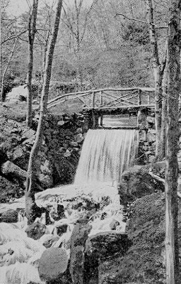
Neponset River Banks, 922.05 acres. Boston, Hyde Park, Dedham, Westwood, Milton, and Canton. Stony Brook Reservation, 463.72 acres. Boston and Hyde Park. Densely wooded hills; Muddy Pond; fine driveways. Reached by trolley car for Dedham from Forest Hills. Charles River Banks, 635.80 acres. Boston, Cambridge, Watertown, Waltham, Weston, Newton, and Wellesley. Beaver Brook and Waverley Oaks Reservation, 58.35 acres. Belmont and Waltham. Contains the famous old oak trees and a picturesque brook (subject of Lowell’s “Beaver Brook “), with ponds and waterfall. Reached by Waverley car from Subway or by train on Boston & Maine Railroad (Fitchburg or Central Massachusetts division) to Waverley station (short walk).
Hemlock Gorge Reservation,
23.06 acres. Newton, Needham, and Wellesley. The Charles River cuts
its way here through a narrow, deep gorge shaded with fine old trees.
Echo Bridge is across the river above the gorge, — a symmetrical
piece of masonry, with a wonderful echo beneath it. Reached by car
via Newton, or by Boston & Worcester (electric) car via Boylston
Street, Brookline; also by train (Newton Circuit, New York Central)
to Newton Upper Falls.
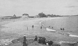
King’s Beach and Lynn Shore Reservation, 22.89 acres. Swampscott and Lynn. Along the ocean front of the northern part of Lynn and the southern shore of Swampscott. Reached by trains to Lynn and trolley cars for Swampscott through Ocean Street. Lynn Woods, Free Public Forest, 2000 acres. Comprising woodland of great natural beauty, maintained by the Lynn Park Commission. The second largest municipal pleasure ground in the United States. Three main entrances: one to the Great Woods Road; second, to Dungeon Rock, on Wal nut Street — both these reached by electric cars properly marked, from the square in Lynn at the central railroad station; the third or western entrance, from the old Reading road to Walden Pond — most convenient for carriages and bicycles from Boston and suburbs. Hart’s Hill, 22.97 acres. Wakefield. Reached by trains on Boston & Maine Railroad (Western Division) to Wakefield, or by trolley car from Sullivan Square terminal of the elevated railway via Malden and Melrose. Governor Hutchinson Field. Milton. Part of the estate of the royal governor in the years immediately preceding the Revolution. Fine view of the Neponset River and its meadows, Boston city and harbor, and Massachusetts Bay. Reached by train or trolley car to Milton Lower Mills, and walk of ten minutes through Adams Street. Furnace Brook, 3.72 miles in length. Quincy. Blue Hills, 2.265 miles. Boston and Milton. Neponset River, 2.260 miles. Hyde Park and Milton. West Roxbury, 1.510 miles. Boston, West Roxbury District. Fresh Pond, .520 mile. Cambridge. Middlesex Fells, 5.105 miles. Malden, Medford, Somerville. Mystic Valley, 2.900 miles. Medford, Winchester. Revere Beach, 5.240 miles. Revere, Chelsea, Everett, Medford. Lynnway, .690 mile. Revere, Lynn. Nahant Beach, 2.230 miles. Nahant. Lynn Fells, 1.040 miles. Melrose, Stoneham. Winthrop, 1.420 miles. Revere. Alewife Brook, 2.557 miles. Cambridge, Somerville, Arlington, Belmont. |
 Click the book image to turn
to the next Chapter.
Click the book image to turn
to the next Chapter.